
Map of Australia Poster
| Buy in bulk & save! | |
|---|---|
| Buy 1 to 4: | $7.95 each |
| Buy 5 to 9: | $7.75 each |
| Buy 10 or more: | $7.55 each |

Available on orders $80 to $1000
Learn more

Available on orders $80 to $1000
Learn more
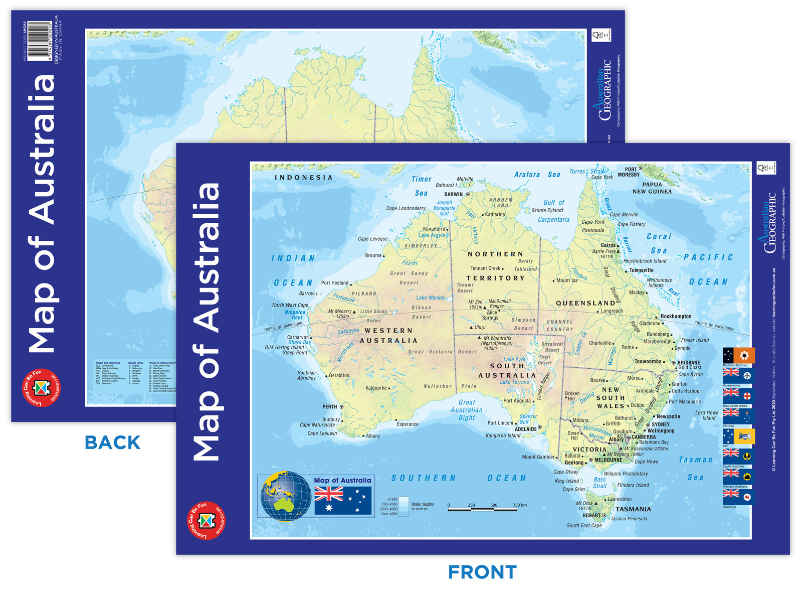
The Map of Australia by Learning Can Be Fun and Australia Geographic is a complete, easy to read map of Australia.

The Map of Australia by Learning Can Be Fun and Australia Geographic is a complete, easy to read map of Australia.
The map shows all state borders, capital cities, major towns and airports. Surrounding seas, oceans, reefs, lakes and major rivers are also shown - noting the various shades of blue to reference the depth of water. Each state flag is shown down the right-hand side of the map and the Australian flag at the bottom left hand side of the map. The reverse side allows you to test your knowledge of Australia by placing the landmark to their geographical position.
This chart is laminated, featuring a 'wipe-clean' surface which can be used with a non-permanent marker.
| SKU | LMOAP |
| ISBN | 9314289029203 |
| Publisher | Learning Can Be Fun |
| Product Type | Posters, Charts & Mats, |
| Year Level | Early Years, Foundation, Year 1, Year 2, Year 3, Year 4, Year 5, Year 6, |
Be The First To Review This Product!
Help other Teacher Superstore users shop smarter by writing reviews for products you have purchased.
